Casciani trails
The best trails for hikers
Inserted in the woods rich in Mediterranean scrub and enclosed between the medieval village of Gambassi Terme, the Via Francigena and the Via del Sale directed to Volterra, the paths wind along the valley floor where the river Casciani flows.
This fascinating territory contains historical, landscape, folkloristic and cultural elements linked by a common thread: water.
The historic aqueduct, the mysterious refuge of the hermit Maurizio, the small Bollori gayser, the ruins of ancient mills… water as an essential resource for the natural and cultural life of these places.
Along the river, between characteristics jumps and river thunders, the trails are divided into five trails:
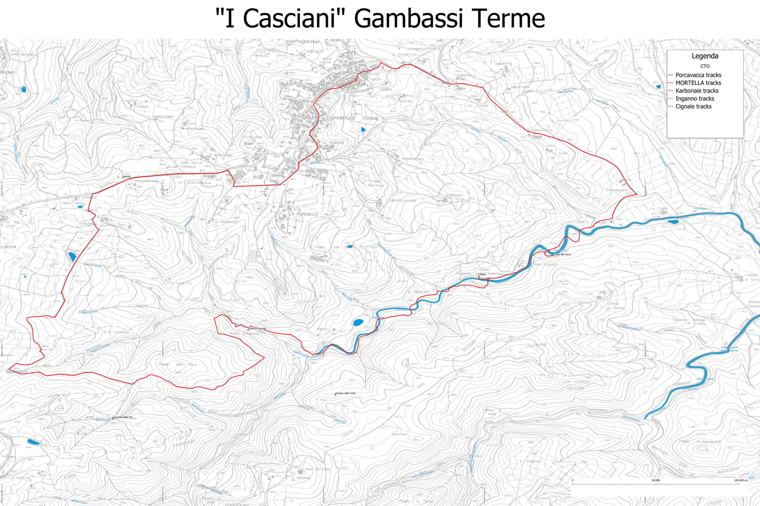
The first, the most extensive, in which the others loops intersects, will lead you directly from the village to the valley floor, guiding you inside the mixed deciduous and Mediterranian scrub forest.
The other four, which are shorter and interconnected, will give you the opportunity to explore the area in more depth as you see fit.
Tourist informations:
Trail n. 1 – Anello dei Casciani
- Journey time: around 5h
- Kilometers: 13,3
- Color: Red
- Difficulty: EE
Itinerary
Departure from the village of Gambassi Terme, descending along the Via Francigena towards San Gimignano (stage 31), deviation on the right along the river.
Crossing some fords we reach the emergencies of Grotta alla Vacca and then Bollori and Putizza.
Continuing along the bed of the torrent we reach the Grotte di Maurizio.
Going up towards the old aqueduct of the Forra and return to the center of Gambassi passing by the small church of Santa Cristina and the medieval archaeological excavations of Germagnana.
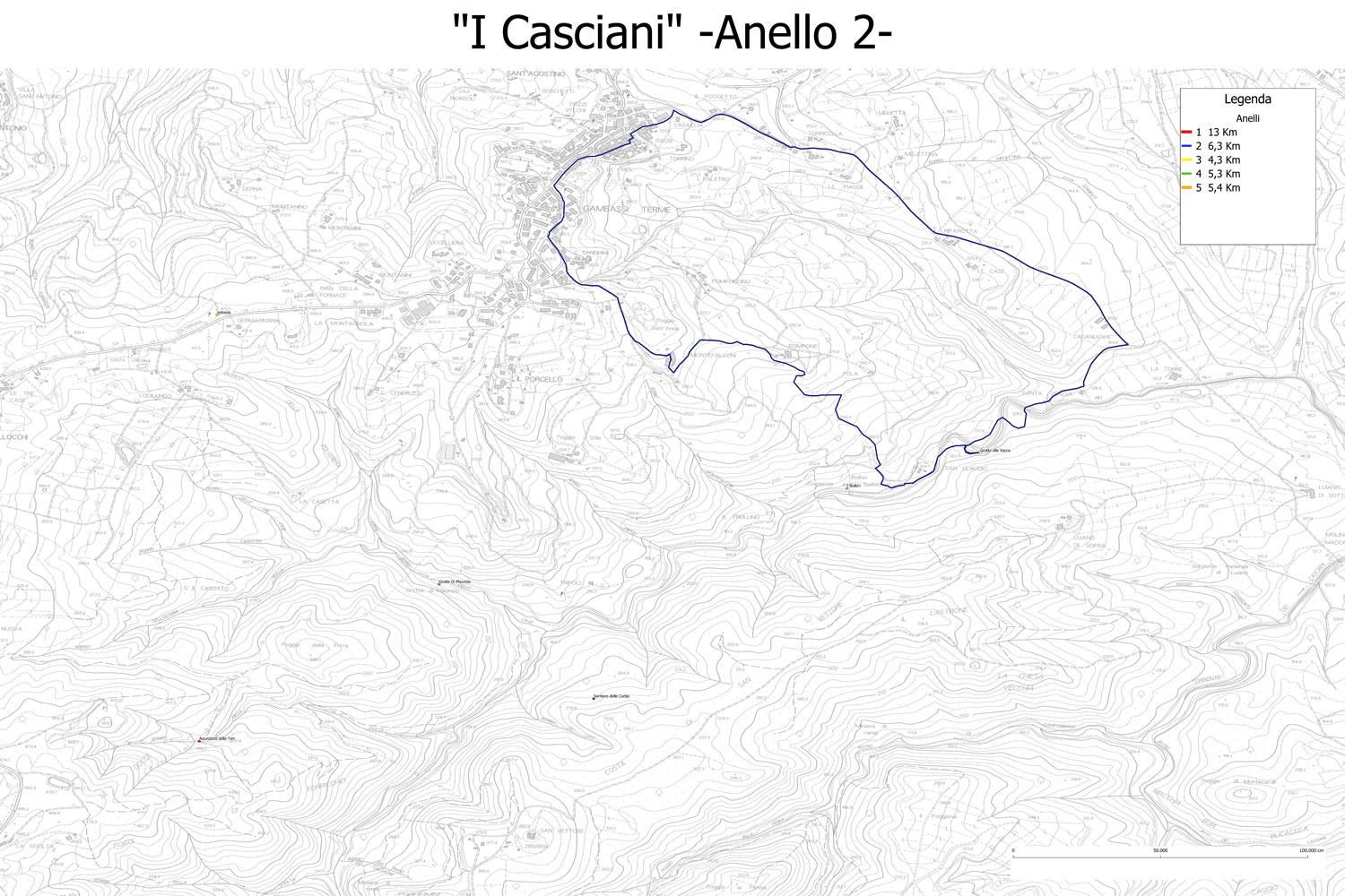
Trail n. 2 – Anello dei Bollori
- Journey time: around 2,5 h
- Kilometers: 6,6
- Color: Blue
- Difficulty: EE
Itinerary
Departure from the village of Gambassi Terme, descending along the Via Francigena towards San Gimignano (stage 31), deviation on the right along the river.
Crossing some fords you reach the emergencies of Grotta alla Vacca and then Bollori and Putizza.
Return towards Gambassi along the path that crosses typical Tuscan cultivation lands in Pompone and Pola.
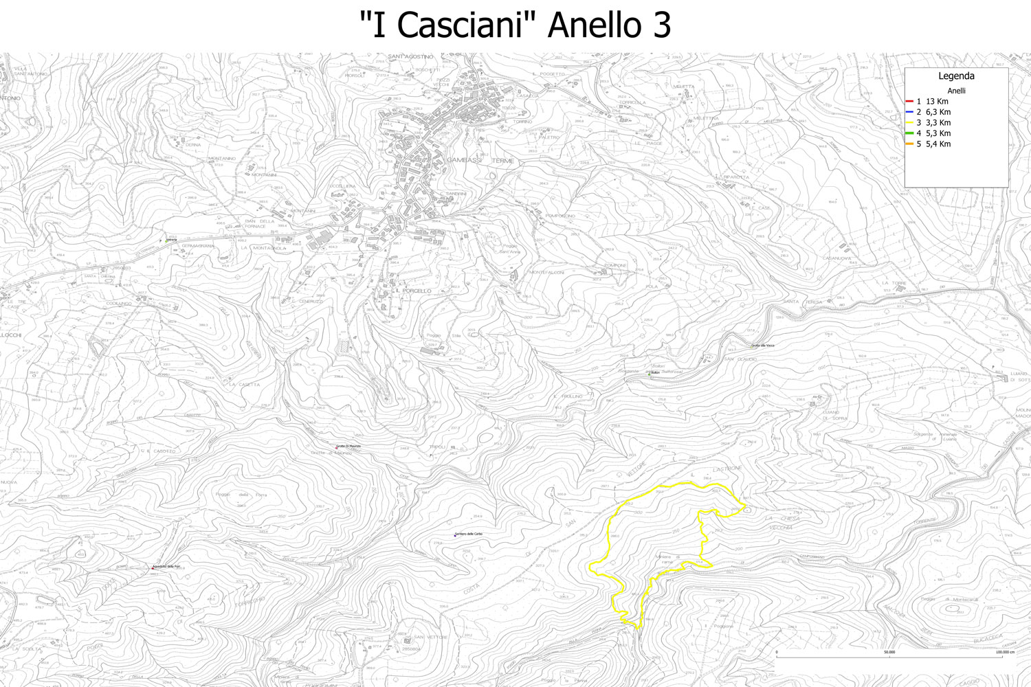
Trail n. 3 – Anello delle Miniere
- Journey time: around 2h
- Kilometers 3,3
- Color: Yellow
- Difficulty: EE
Itinerary
Departure from costa di San Vettore (trail n. 4), after a short stretch, you will find a detour that leads to the panoramic point Il Massone from which you can admire the valley.
Returning to the main path, you discend through the woods along the stream Rio dell’acqua calda.
You will first the copper mines Miniere della Casaccia, on the opposite site of the path, and then the Tonfo del Capoccio.
The route continues to the woods until it rejoints Costa di San Vettore, completing the loop.
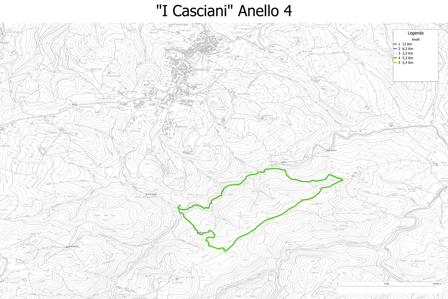
Trail n. 4 – Anello delle Carbonaie
- Journey time: around 2h
- Kilometers: 5,1
- Color: Green
- Difficulty: EE
Itinerary
The ring starts in the immediate vicinity of the agriturismo La grotta dell’Eremita.
You go up along the Carbonaie path to reach the coast of San Vettore (Via del Sale), which you follow on the ancient paved road until you cross the ring n.3.
Return following the bed of the torrent crossing several fords (possible deviation in case of high water).
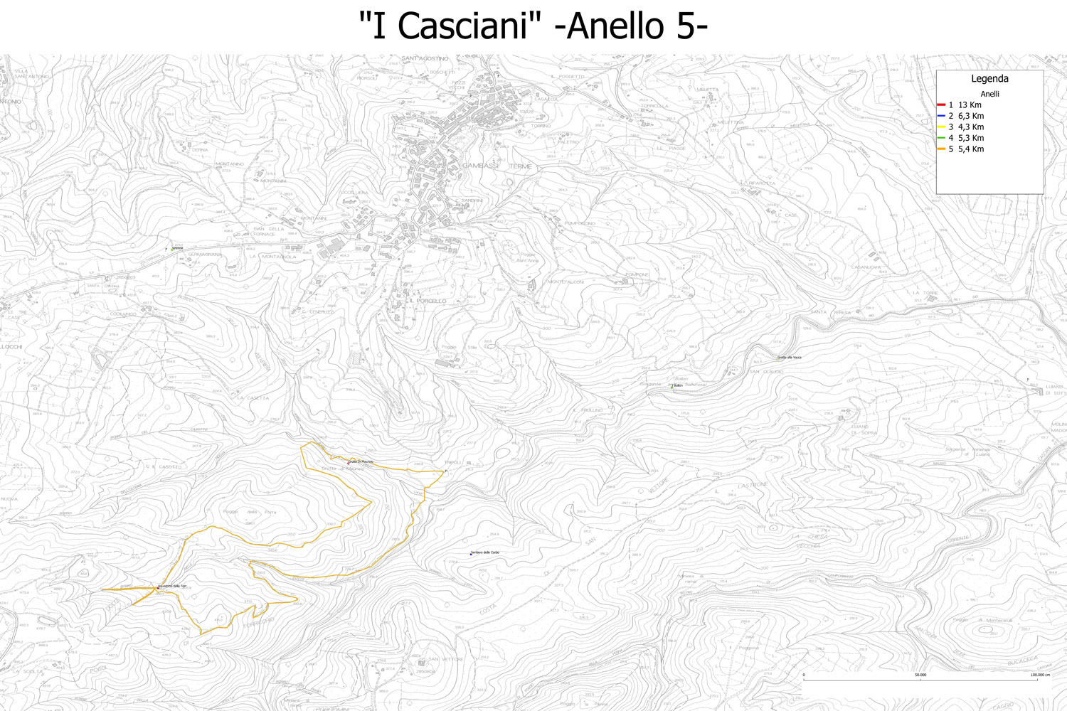
Trail n. 5 – Sentiero dell’Acquedotto
- Jouney time: about 45 minutes
- Kilometres: 2
- Color: Orange
- Difficulty: EE
Itinerary
Approach from the locality i Fiori. Departure of the path from the electricity cabin, continue to the right reaching the Acquedotto della Forra.
Once visiteted the galleries of the Acqueduct, you are ready to return on your steps.

